Showing 58 items matching gold deposits
-
 Federation University Historical Collection
Book, Geological Gossip or Stray Chapters on Earth and Ocean, 1860
... gold deposits...Brown hard covered book. Chapter 16 is on gold deposits... hard covered book. Chapter 16 is on gold deposits and discusses ...Brown hard covered book. Chapter 16 is on gold deposits and discusses the discovery of gold in California and Australia.Brown hard covered book geology, water, rivers, the atlantic, great deep, africa, australian interior, eyre's expedition, murray river, darling river, earthqaukes, leichardt, moreton bay, volcanos, darwin's theory, evolution, egyptian race, human remains in caverns and gravel, rocks, metamorphism, iron ores, coal, coal fields, gold deposits, california, water-glass, artificial stone, porous stones, cements -
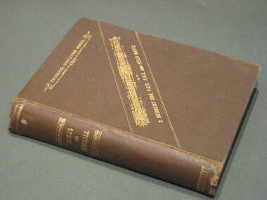
 Federation University Historical Collection
Book, D.C. Davies et al, Metalliferous Minerals and Mining, 1892
... gold deposits... mountains gold deposits virginia new england new brunswick brazil ...Brown hard covered, illustrated book of 518 pages. It includes a bookplate of the Ballarat Ironworkers' and Polytechnical Association Library Rules. The book was bequethed to the Ironworkers' Association by the late James Oddie.mining, minerals, quartz, nova scotia, california, germany, ural mountains, gold deposits, virginia, new england, new brunswick, brazil, australia, new south wales, mount morgan, new zealand, africa, statistics, india, phillipines, aruba island, silver, russia, nevada, ruby hill, nevada, utah, emma mine, nevada, colarado, red mountain district, colorado, yankee girl mine, arizona, mexico, peru, bolivia, chili\copper, south africa, italy, austria, norway, swedan, france, cornwall, dolcoath mine, sandstone, parys mines of anglesea, carnarvonshire, cardiganshire, wicklow, ireland, mississippi valley, wisconsin, lake superior, wyoming, cuba, jamaica, venezuela, south australia, york peninsula, flinders ranges, japan, tin, banca, malaysia, bohemia, saxony, sweden, spain, cligga point, rin lodes of cornwall, andalusia, belgium, shropshire, isle of man, durham, westmoreland, limestone, flintshire, dengigshire, canada, lead, zinc, siberia, hungary, silesia, sardinia, algeria, ireland, new jersey, iron, lancashire, missouri, michigan, superstitions, equipment, cages, stopes, winzes, timbering, ventilation, fans, drilling, boring, dynamite, electricity, blasting, horse whims, water wheels, boilers, petterson's elephant ore stamp, stamper battery, jogs, linkenbach table, panning, cradle, quartz mining, hydraulic mining, alluvia; mining, altai mountains, north wales, neugluck mine, freiberg, christbescherung mine, drei prinzen lode, miask, woodville, virginia, gongo soco, brazil, sierra nevada, california, st john del rey mine, brazil, leydenberg gold field, south africa, banket reefs, transvaal, kongsberg, norway, santa rosa mine, peru, huelva, spain, dolcoath mine, cornwall, parys mine, anglesea, waterbury copper mine, lake superior, copiapo, chilli, altenberg, saxony, whea; uny, cornwall, wast wheel mine. redruth, cornwall, cligga point, cornwall, old hewas mine, cornwall, hartz, germany, snailbeach mine, shropshire, llangynog, north wales, van mine, mongomeryshire -
 Tarnagulla History Archive
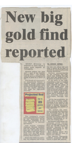
Newspaper clipping: 'New Big Gold Find Reported', 1990s
... a major gold deposit near Tarnagulla. ... finding a major gold deposit near Tarnagulla. Donald Clark ...Donald Clark Collection.A newspaper clipping from unknown newspaper, article titled 'New Big Gold Find Reported' about Reef Mining NL finding a major gold deposit near Tarnagulla. -
Federation University Historical Collection
Book, R. Kirke Rose, The Metallurgy of Gold, 1898
... The Metallurgy of Gold, 1898 Red hard covered, indexed book of 528 pages ...T. Kirke Rose was an Associate of the Royal School o fMines, an Fellow of the Chemical Society amd ASsistant Assayer of the Royal Mint.Red hard covered, indexed book of 528 pages, with numerous illustrationsInside front :To Alfred John Hill with all good wished for a successful career from Alf Mica Smith Daniel Walker School of Mines Ballarat June 1900alfred mica smith, daniel walker, alfred john hill, mining, metallurgy, alloys, gold, cyanides, shallow deposits, water, quartz crushing, stamp battery, chilian mill, stanford's feeder, mercury, screens, concentration, hartz jigs, percusion tanle, roastin, butters mill, kennel, california, pyritic smelting -
 Bendigo Historical Society Inc.
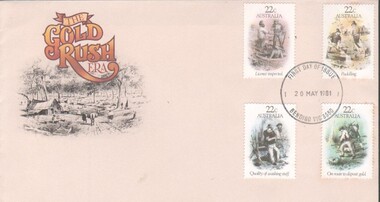
Memorabilia - First Day issue of four gold related stamps, first day issue envelope and stamp folder, 5/09/2023
... of washing stuff, & On route to deposit gold)... to deposit gold) First day of issue stamped envelope - 20/05/1981 ...First Day of issue of four Gold related stamps.First Day issue envelope and stamp pack for four 22 cent gold related stamps (Licence inspection, Puddling, Quality of washing stuff, & On route to deposit gold)First day of issue stamped envelope - 20/05/1981 Bendigo, Vic, 3550four gold related stamps., stamps -
 Federation University Historical Collection
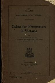
Book, Guide for Prospectors in Victoria, 1931
... : working alluvial deposits, equipment, geology of Victoria, gold...: working alluvial deposits, equipment, geology of Victoria, gold ...The handbook was intended for those with little experience who wanted to prospect of fossick.Grey soft covered book of 90 pages. Includes fold out map of a portion of Victoria showing auriferous areas and mineral localities. Also show Counties of Victoria and localities of minerals such as tin, antimony, copper, silver lead, Malybdenite, tungsten ores, manganese, platinum, osmiridium and iron. Chapter heading s include: working alluvial deposits, equipment, geology of Victoria, gold deposits, quartz reefs, indicators, economic minerals, assistance to prospectors, Miners' Right, mining bye-law, mining leases, forest regulations and glossary. Descriptions are given of a god dish, puddling tub, cradle, puddling machine, ground sluicing, boring, windlass, whim, hand dollying, sweeping, California pump, and wing dam.mining, baragwanath, gold, prospector, geology, quartz reefs, alluvial deposits, indicators, victorian goldfields, miners rights, mining leases, forest regulations, sluicing, sluice box, puddling machine, miner's cradle, whim, whip, california pump, gold nuggets, saddle reef, ballarat indicators, state batteries -
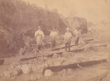
 The Beechworth Burke Museum
Photograph - Photograph - Reproduction, W. D. Gibbon, Early 1900s
... alluvial gold deposits located about 5km south of Beechworth... alluvial gold deposits located about 5km south of Beechworth ...This photograph was taken in 1911 at Three Mile Creek, about five kilometers south of Beechworth town. Significant digging took place at this location from late 1855, which led to a flood of workers and stores to follow, though daily earnings were slim compared to the nearby Woolshed site. This remained the case even after workers at Three Mile Creek attempted to protest around Beechworth during an election in November 1855. Three Mile Creek was one of seven significant divisions of the Beechworth Mining District formalised by the Governor-in-Council in 1858, though by the time this photograph was taken, the boundaries of the original seven districts had shifted to create seventeen divisions. The Three Mile Goldfields was a site of rich alluvial gold deposits located about 5km south of Beechworth in Victoria. Today, the location of this gold deposit is called Baarmutha. It was a popular area for gold mining in the 1850s but became largely abandoned by the following decade. In 1865, a man named John Pund (a man second from the left in the back row of this photograph shares this surname) recognized that the area could be potentially rich if a better water supply could be obtained. He secured a 15 year license with three other miners. Within the next five years, these men had constructed 19 km of water race going from Upper Nine Mile Creek to Three Mile Creek. By 1881, these four men had delivered 950,000 gallons to the Three Mile Sluicing area which is depicted in this photograph. Pund would later go into partnership with John Alston Wallace who would become owner of the Star Hotel in Beechworth. The Three Mile sluicing location continued to be operational until 1950. The eleven miners in this photograph are: Back row: Led Guthrie, P. Pund, F. Beel, [Unknown] Miller Front row: Paddy McNamara, J. King, W. Beel, [Unknown] Garland, J. Clarke, J. Ryan, H. Bartsh In the background of the photograph is a huge dirt wall that appears to suffer damage caused by hydraulic sluicing. Hydraulic sluicing is a specialised mining technique that involves directing high pressure water flows at dirt to uncover gold. The technique played a significant role in shaping Beechworth's landscape during the gold rush to create the topography seen today.The search for gold is ingrained into the history of Victoria and therefore, images like this one which portray an open cut sluicing site can reveal important information for society and technology for the date when the photograph was taken. This image is of important historical significance for its ability to convey information about sluicing and the methods used to find gold in the late 1800s and early 1900s. It also shows a location where sluicing was undertook which provides insight into the impact of sluicing on the environment at a time when it was done. Images, like this one, of Australian gold rush history can reveal important information about the social and environmental impact of this period. This image depicts diggers standing in a mining location and therefore, this image has the capacity to reveal or support significant information for researchers studying the fashion and social status of diggers in Australia in approximately 1911. It can also provide information on the landscape of Australia in this period and the impact of mining for gold on both society and the Australian landscape. The Burke Museum is home to a substantial collection of Australian mining photographs which can be used to gain a deeper understanding into life on the gold fields, technology used in mining, the miners themselves and the impact of the gold digging on the environment.Black and white / sepia rectangular reproduced photograph printed on glossy photographic paper mounted on board.beechworth, beechworth museum, mining, mining team, three mile creek, sluicing, hydraulic sluicing, photography, gold sluicing, gold mining, pund mining -
 The Beechworth Burke Museum
Photograph, c.1870
... Goldfields was a site of rich alluvial gold deposits located about 5... was a site of rich alluvial gold deposits located about 5 km south ...This photograph was taken in approximately 1870 and depicts four male miners standing in mining sluice at the Three Mile Goldfields. These men are wearing typical attire for 1870s gold miners. They wear white shirts, tan coloured pants with water proof shoes and most of the men are wearing an apron to prevent their clothing from becoming too dirty from the mud. Each man is wearing a wide brim hat and hold large wooden tools used for sorting through the sluice. Three of the four men have full beards. The photograph was donated to the Burke Museum by R. Ziegenbein before 2001 but the photographer and the individuals captured in the photo are unknown. The image depicts the landscape of the Three Mile Goldfields during a period when open cut sluicing was undertaken to reach gold. Open cut sluicing is a method used to extract gold and other precious metals from beneath the surface of the earth. This technique involved the use of high-powered hoses which broke down the soil enabling miners to come along and search this soil for gold. After the gold rush of the early 1850s, diggers had to enlist the assistance of heavy machinery and techniques like hydraulic sluicing in order to reach gold because the surface alluvial gold had already been discovered and removed. This heavy machinery was not used until after 1853. The Three Mile Goldfields was a site of rich alluvial gold deposits located about 5 km south of Beechworth in Victoria. Today, the location of this gold deposit is called Baarmutha. It was a popular area for gold mining in the 1850s but became largely abandoned by the following decade. In 1865, a man named John Pund recognized that the area could be potentially rich if a better water supply could be obtained. He secured a 15 year license with three other miners. Within the next five years, these men had constructed 19 km of water race going from Upper Nine Mile Creek to Three Mile Creek. By 1881, these four men had delivered 950,000 gallons to the Three Mile Sluicing area which is depicted in this photograph. Pund was later go into partnership with John Alston Wallace who would become owner of the Star Hotel in Beechworth. The Three Mile sluicing location continued to be operational until 1950. Sluice box workers were a vital part of gold mining regardless of how inefficient they were in the recovery of gold. After using hydraulic sluicing to cut away the earth, miners would use the big wooden boxes depicted in the image to catch the earth which would then be sifted for gold. However, accidents would occur often which would result in the gold washing away and unable to be recovered. It was not a very efficient system because the gold, which was alluvial and thus very fine, would often pass through the sluice box undetected.The search for gold is ingrained into the history of Victoria and therefore, images like this one which portray an open cut sluicing site can reveal important information for society and technology for the date when the photograph was taken. This image is of important historical significance for its ability to convey information about sluicing and the methods used to find gold in the late 1800s and early 1900s. It also shows a location where sluicing was undertook which provides insight into the impact of sluicing on the environment at a time when it was done. Images, like this one, of Australian gold rush history can reveal important information about the social and environmental impact of this period. This image depicts diggers standing in a mining location and therefore, this image has the capacity to reveal or support significant information for researchers studying the fashion and social status of diggers in Australia in approximately 1870. It can also provide information on the landscape of Australia in this period and the impact of mining for gold on both society and the Australian landscape. The Burke Museum is home to a substantial collection of Australian mining photographs which can be used to gain a deeper understanding into life on the gold fields, technology used in mining, the miners themselves and the impact of the gold digging on the environment.Sepia toned rectangular photograph printed on matte photographic paper and mounted on board.[illegible] about 1870 / 97 2514.1 / 2594 30three mile goldfields, goldfields, 1870, 1870 gold, australia, australian landscape, miners, gold miners, diggers, gold diggers, beechworth, victoria, sluice box workers, sluicing, sluice, mining -
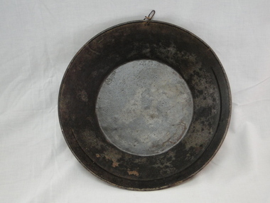 Bright & District Historical Society operating the Bright Museum
Pan gold
... Used for separating gold particles from alluvial deposits... Museum 2 Station Street Bright high-country Pan gold Used gold ...Used for separating gold particles from alluvial deposits. After washing the alluvial gravel in water the gold is trapped in a ring on the side of the pan. This pan has a ring half way round the rim of the pan.Typical gold pan that would have been used in gold fields of North East VictoriaUsed gold pan. 300mm diametergold, gold pan, goldfields -
Stawell Historical Society Inc
Joiner, Joiner from Diamond Drill, C. 1955
... Dimond drills are put down to identify locations of gold... drills are put down to identify locations of gold bearing ore ...Dimond drills are put down to identify locations of gold bearing ore deposits, before mining drives are put in to extract the Ore. Sectionso fth eDimond Drill core are analyised for gold content. Drill joiner found near shaft no 26 in Ironbarks, near the intersection of Golf Course & southwest road. Conctrete shaft Cover still in PlaceMetal pipe threaded at both ends, used to join diamond Drill pipeing c 1955mining, gold -
 Federation University Historical Collection
Book, Hydraulic and Placer Mining, 1898, 1905
... ; Geology of Placer Deposits; Gold Recovery; Flumes, ditches, dams... of Placer Deposits; Gold Recovery; Flumes, ditches, dams, pipes ...Blue/black hard covered book of 234 pages including index and photographic reproductions. Contents include Uses of Water in Mining; Geology of Placer Deposits; Gold Recovery; Flumes, ditches, dams, pipes; Giants, valaves, gates, weirs, miner's inch, pressure box, dams; gravel elvators; exploiting. mining, hydraulics, water, dredge, dredging, gold mining -
Tarnagulla History Archive
Set of Maps (Mining & Local Area), various
... Leads - showing location and names of deep lead gold deposits... Leads - showing location and names of deep lead gold deposits ...David Gordon Collection. A set of mining documents, maps and plans: 1. Dunolly Deep Leads - showing location and names of deep lead gold deposits in region around Dunolly including at Tarnagulla and Newbridge. Geological Survey of Victoria, Department of Minerals and Energy. Bulletin No. 62, Map No. 4 Dunolly (770 x 485 mm). 2. Poseidon Lead (Facsimile) 3. Nick O Time Lead (Facsimile) 4. Happy Go Lucky Mine prospectus and plan (colour copy) 5. Jones Creek GM Co. (Raven & Gourlay's) Waanyarra - Prospectus (colour copy) 6. Poseidon Area Plan (colour copy) and Poseidon Area map (B&W copy). 7. Cross-section diagram of Spread Eagle Reef 8. New Birthday Gold Mine - area map (colour copy) and mine cross-section ( (colour copy). 9. Cross section of Poverty Reef, by Department of Mines (B&W copy, 2 parts on A2 paper) 10. Time-Lease Graph for Watts Reef, Specimen Reef, Stony Reef, Poverty Reef (second page in detail), created by Eric WIlkinson for Ref Mining NL, 1995 11. 1859 Plan of the Gold Workings & Township of Sandy Creek, Shewing the Mining Leases, Extended Claims & Machinery by R.J. McMillan, Mining Surveyor (B&W copy) 12. Longitundinal and Transverse Vertical Sections of Poverty Reef, Sandy Creek 1859, by R.J. McMillan, Mining Surveyor (B&W copy) 13. Tarnagulla Locality Plan (B&W copy) 14. Universal Grid Reference Map (Topographic) for Laanecoorie North (2 copies) 15. Universal Grid Reference Map (Topographic) for Inglewood South 16. Poverty Reef, Plan showing shafts and early tenements, created by Eric WIlkinson for Ref Mining NL, 1995 17. Locality Map of mining leases in Tarnagulla 18. Plan and Elevation of part of Poverty Reef, Sandy Creek, showing the claims and positions of the shaft. by R.J. McMillan, Mining Surveyor (Facsimile, composed of taped together components) 19.Plan and Elevation of part of Poverty Reef, Sandy Creek, showing the claims and positions of the shaft. by R.J. McMillan, Mining Surveyor (Facsimile, composed of taped together components) -
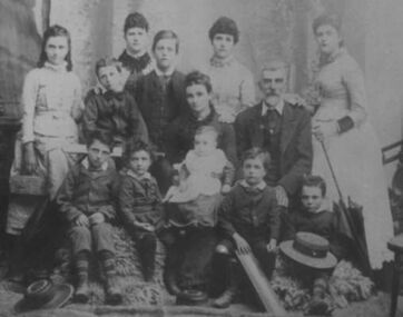 Croatian-Australian Immigration Museum
Family photograph, Vincent Gercovich family, c. 1889
... rich deposits of gold and for obvious reasons many came to join... of gold discovery. Victoria had a few rich deposits of gold ...Vincent Gercovich married Winifred Rebecca Bennett (English emigrant) on 13 February 1867 in St. Alipius church in Ballarat. They had a total of 12 children. Little is known about his life, but what is known that he was well disposed to several languages and due to his ability to communicate with immigrants worked at the entry gate to the city of Ballarat. He died at the age of 61. Vincent was one of these early Croatian immigrants who came to Victoria around 1850s. His surname Gercovich (probably Gerković or Jerković) came from the island of Hvar on Dalmatian coast. On his Australian citizenship documents, the place of birth was stated as Dalmatia, Austria. From research of collected documents it can be concluded that the first Croats arrived to this country some 150 years ago mainly because of gold discovery. Victoria had a few rich deposits of gold and for obvious reasons many came to join the great ‘Gold Rush’.A black and white family photograph features Gercovich family with 12 children photographed in a studio around 1889. Children ages on the photograph range from unborn to young adults.vincent and winifred gercovich, gercovich, early croatian immigrants, immigration, croatia, dalmatia, ballarat, gold rush -
 The Beechworth Burke Museum
Geological specimen - Dolomite
Dolomite is a mineral, calcium magnesium carbonate, with the chemical formula CaMg(CO3)2. It is a principle component of various rock types sometimes also referred to as dolomite, including dolostone, dolomitic marble and dolomitic limestone (according to the composition of each type). Dolomite rock is found in sedimentary basins throughout the world, comprising approximately 2% of the Earth's crust. It is formed when lime mud or limestone encounters groundwater containing magnesium. Dolomite can contain elements such as lead, zinc and copper. Dolomite and limestone are used in various construction, landscaping and agricultural processes. This specimen was donated to the Burke Museum in 1868 by Alfred Selwyn as part of the Geological Survey of Victoria. It was donated to the Museum in 1868. Victoria and other regions of Australia were surveyed for sites of potential mineral wealth throughout the 19th Century. The identification of sites containing valuable commodities such as gold, iron ore and gemstones in a locality had the potential to shape the development and history of communities and industries in the area. The discovery of gold in Victoria, for instance, had a significant influence on the development of the area now known as 'the goldfields', including Beechworth; the city of Melbourne and Victoria as a whole. Dolomite and limestone are mined at several locations in Victoria, including sites in the North-East of the state in Bindi and Limestone Creek. There are notable dolomite deposits in most Australian states. The dolomitised form of the mineral tends to come from older limestone deposits, formed during the palaeozoic era in marine settings, so this specimen may have come from a deposit located along a coastline in Victoria or another state. The specimen is significant as an example of surveying activity undertaken to assess and direct the development of the mineral resource industries in Victoria and Australia, as well as the movement to expand human knowledge of earth sciences such as mineralogy and geology in the nineteenth century. This specimen is part of a larger collection of geological and mineral specimens collected from around Australia (and some parts of the world) and donated to the Burke Museum between 1868-1880. A large percentage of these specimens were collected in Victoria as part of the Geological Survey of Victoria that begun in 1852 (in response to the Gold Rush) to study and map the geology of Victoria. Collecting geological specimens was an important part of mapping and understanding the scientific makeup of the earth. Many of these specimens were sent to research and collecting organisations across Australia, including the Burke Museum, to educate and encourage further study.Hand-sized piece of pale pink dolomite (calcium magnesium carbonate) with dark grey rim and hollowed centre. geological specimen, geology, geology collection, burke museum, beechworth, dolomite, mineralogy, geological survey, alfred selwyn, limestone, calcium magnesium carbonate -
 The Beechworth Burke Museum
Geological specimen - Kaolin, unknown
Kaolin is also known as china clay. This specimen came from Dunolly, Victoria and was donated to the Museum in 1868 as part of the Geological Survey of Victoria. This survey helped map and study the geology of Victoria. In Victoria, Kaolin is particularly used as a filler and coating material in paper manufacture. It can also be used in paints, ceramics, rubbers and plastics. There are many kaolin deposits in Victoria but many of these have been mined out and there is not much Kaolin left. Rocks that have a high amount of Kaolinite and it can be formed through the decomposition of other materials. There are two types of Kaolin; hard and soft kaolin. Soft kaolin's are coarse but have a soapy texture. It can also break easily. The hard kaolins have an earthly texture and are finer grained. This means that they are harder to break, unlike the soft kaolin. Hard kaolin's are formed by flocculation in salt water, a process that in basic terms, bonds particles together. Kaolin is a common material in Victoria and that is why it is significant. While this specimen was mined in Dunolly, Victoria Kaolin can also be found Pittong, Pakenham, Bulla, Hallam and Ballarat as well as many other places throughout Victoria. This specimen represents the presence of Kaolin deposits in this region of Australia. It is also significant because Kaolin has many uses and is largely beneficial to many manufacturing processes in Victoria. This specimen is part of a larger collection of geological and mineral specimens collected from around Australia (and some parts of the world) and donated to the Burke Museum between 1868-1880. A large percentage of these specimens were collected in Victoria as part of the Geological Survey of Victoria that begun in 1852 (in response to the Gold Rush) to study and map the geology of Victoria. Collecting geological specimens was an important part of mapping and understanding the scientific makeup of the earth. Many of these specimens were sent to research and collecting organisations across Australia, including the Burke Museum, to educate and encourage further study.Two pieces of Kaolinite mineral with shades of white and graygeological specimen, geology, geology collection, burke museum, beechworth, kaolin, china clay, dunolly, geological survey of victoria, kaolinite, victoria, mining, mining deposits, geology of victoria, australia, filler, coating material, paper manufacture, paint, ceramics, rubbers, plastics, decomposition, materials, soft kaolin, hard kaolin, flocculation, particles, salt water -
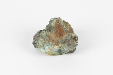 The Beechworth Burke Museum
Geological specimen - Malachite, unknown
Malachite is a water soluble, crystalline, triphenyl methylene chloride salt. It has a close relationship to copper because it is common for Malachite and copper to come from the same ore. Malachite often has shades of green, making it also known as Malachite Green. As a result of it's colour, it is known for being a dye and has been used in the dye industry, the textile industry and in medical fields. Cobar in New South Wales is well known for it's mining. This is because of the number of important deposits present in the area and include three important mining belts where most of the materials are found. These are the 'Cobar belt', the 'Canbelego belt' and the 'Girilambone belt'. The 'Cobar belt' runs underneath the main town. Copper was first discovered in Cobar in 1869 and since then, many deposits of other materials have been found, including Malachite.This specimen is significant because it comes from Cobar, NSW and represents the many deposits of materials found there. Cobar has a long history of mining and is a source of Australia's copper minerals. Malachite is often found in copper deposits meaning that it is representative of Cobar's copper production. Malachite is known for it's vivid green colour and as a result, has many uses, such as meaning used as a dye. This makes it a valuable material and highly significant. This specimen is part of a larger collection of geological and mineral specimens collected from around Australia (and some parts of the world) and donated to the Burke Museum between 1868-1880. A large percentage of these specimens were collected in Victoria as part of the Geological Survey of Victoria that begun in 1852 (in response to the Gold Rush) to study and map the geology of Victoria. Collecting geological specimens was an important part of mapping and understanding the scientific makeup of the earth. Many of these specimens were sent to research and collecting organisations across Australia, including the Burke Museum, to educate and encourage further study.A solid hand-sized mineral with shades of brown , white and light green throughout.geological specimen, geology, geology collection, burke museum, beechworth, malachite, copper, water soluble, cobar, cobar mines, cobar mining, cobar nsw, nsw, new south wales, mining belts, ore, copper ore, malachite green, dye, green, dye industry, textile industry, desposits, canbelego, girilambone, alfred selwyn -
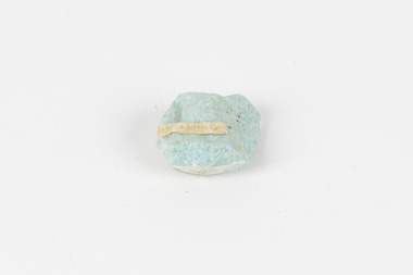 The Beechworth Burke Museum
Geological specimen - Amazonite, unknown
Amazonite is classed as a Tectosilicate and is part of the Feldspar group of minerals. Amazonite forms in a triclinic crystal structure and its chemical formula is K(AlSi3O8). In appearance, Amazonite can range from shades of green to green blue to blue, and often with white streaks or veining. The greenish colour is believed to come from the small amount of lead contained in its composition. Amazonite is named after the Amazon River due to its colour and similarities to another rock found along the riverbanks, although Amazonite is not actually found at or near the Amazon. Although less commonly used in jewellery today, Amazonite has been mined and used by humans for thousands of years and Amazonite jewellery from at least 2000BCE have been discovered in North Africa. Amazonite is found in many locations around the world including Brazil, Peru, Ethiopia, Canada, Russia, Mozambique, Myanmar, Pakistan, China, Madagascar, and the United States of America. This specimen most probably comes from the U.S.A., Amazonite is found in several US states particularly in Colorado, Virginia, Pennsylvania. This specimen is of both scientific and historic significance as a striking blue green example of Amazonite mined prior to 1868 in the United States of America, most likely from Colorado, Virginia, or Pennsylvania. These three states are all locations of significant Amazonite deposits. This specimen is part of a larger collection of geological and mineral specimens collected from around Australia (and some parts of the world) and donated to the Burke Museum between 1868-1880. A large percentage of these specimens were collected in Victoria as part of the Geological Survey of Victoria that begun in 1852 (in response to the Gold Rush) to study and map the geology of Victoria. Collecting geological specimens was an important part of mapping and understanding the scientific makeup of the earth. Many of these specimens were sent to research and collecting organisations across Australia, including the Burke Museum, to educate and encourage further study.A palm-sized Feldspar mineral specimen from the Tectosilicate class in shades of blue-green with white veining.Existing label: green/blue Feldspar / "amazonite" / possibly USA geological specimen, geology, geology collection, burke museum, beechworth, tectosilicate, amazonite, feldspar, triclinic crystal structure, amazonite usa, amazonite colorado, amazonite virginia, amazonite pennsylvania -
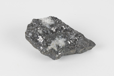 The Beechworth Burke Museum
Geological specimen - Galena (with quartz), unknown
Galena is the natural compound of lead and classed as a sulphide, it crystallises in a cubic pattern and its chemical formula is PbS. Galena is a primary source of both lead and silver. This specimen of Galena comes from Broken Hill. Broken Hill has one of the world’s largest and most significant deposit of ore for the production of lead. Mining of Galena at Broken Hill began with the staking of land by Charles Rasp in 1883. By the following year, in 1884, Rasp and six others had formed Broken Hill Mining Company. Broken Hill Mining Company eventually evolved into BHP group limited and is currently the largest mining company in the world and the largest company in Australia. There is archaeological evidence from artefacts discovered in Turkey that humans have been extracting lead from galena by the process of smelting since at least 6500 BCE. This specimen also has quartz on the top surface which is frequently discovered alongside Galena. This mineral specimen is of historic significance as a sample of Galena extracted from Broken Hill during the 19th century. Mining for Galena in Broken Hill begin in 1883 by Charles Rasp and evolved into the world’s largest mining company – BHP Group Limited. Broken Hill is one of the world’s most significant deposits of ore for the production of lead. This specimen is part of a larger collection of geological and mineral specimens collected from around Australia (and some parts of the world) and donated to the Burke Museum between 1868-1880. A large percentage of these specimens were collected in Victoria as part of the Geological Survey of Victoria that begun in 1852 (in response to the Gold Rush) to study and map the geology of Victoria. Collecting geological specimens was an important part of mapping and understanding the scientific makeup of the earth. Many of these specimens were sent to research and collecting organisations across Australia, including the Burke Museum, to educate and encourage further study.A flat, hand-sized, grey sulphide specimen that is the natural compound of lead with a quartz formation on the top surface. Existing Label: GALENA / (with quartz) / Locality: Broken Hill / N.S.W 120 x 70 x 29geological specimen, geology, geology collection, burke museum, beechworth, galena, galena quartz, quartz, charles rasp, broken hill mining company, bhp group limited, bhp, lead, ore, lead sulphide, sulphide, silver, broken hill -
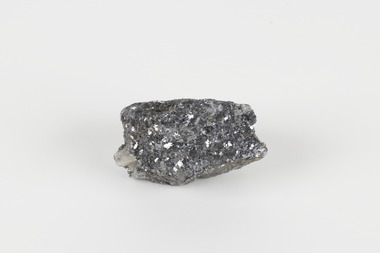 The Beechworth Burke Museum
Geological specimen - Galena (lead sulphide), Unknown
Galena occurs in a range of deposit contexts, often in metalliferous veins, such as Broken Hill, Australia; Coeur d’Alene, Idaho, United States.; Clausthal Zellerfeld, Germany; and Cornwall, England. Large deposits also replace limestone, dolomite, or occasionally organic matter, or have a contact-metamorphic origin. Galena is additionally found in cavities, brecciated (fractured) zones in limestone and chert, and in coal beds. This specimen was recovered from Broken Hill NSW and is 60% lead with 8-12 oz/silver to the ton.Galena or 'lead glance' is a grey lead sulfide and the chief ore mineral of lead. It forms isometric crystals in which the ionic lattice is similar to sodium chloride. Galena is brittle and easily weathers to secondary lead minerals, with the upper part of mineral deposits often containing cerussite, anglesite, and pyromorphite. It usually contains silver, which is mined along with its lead content. Other commercially important minerals that form in close association with galena are antimony, copper, and zinc. This specimen is part of a larger collection of geological and mineral specimens collected from around Australia (and some parts of the world) and donated to the Burke Museum between 1868-1880. A large percentage of these specimens were collected in Victoria as part of the Geological Survey of Victoria that begun in 1852 (in response to the Gold Rush) to study and map the geology of Victoria. Collecting geological specimens was an important part of mapping and understanding the scientific makeup of the earth. Many of these specimens were sent to research and collecting organisations across Australia, including the Burke Museum, to educate and encourage further study.A small-sized solid specimen containing one mineral with a sparkly silver metallic lustre exterior and pastel-grey interior.geological specimen, geology, geology collection, burke museum, beechworth, galena, lead sulphide, alfred selwyn, broken hill -
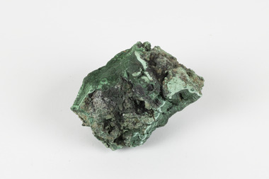 The Beechworth Burke Museum
Geological specimen - Malachite, Unknown
Malachite is a copper carbonate hydroxide mineral. It has a chemical composition of Cu2(CO3)(OH)2. It often forms within limestone where a subsurface chemical environment favourable for the formation of carbonate minerals can occur. It is a substance that can be found in many different parts of the world including: Australia, USA, Russia and the Democratic Republic of Congo. Malachite has historically been used to produce copper, with mining of the mineral dating back over a period of four thousand years. Due to its beautiful green colourations, it is also commonly used for aesthetic purposes such as in the production of sculptures and jewellery. This particular specimen was collected from the town of Burra, South Australia as part of a geological survey undertaken during the nineteenth century. The locality (located on Ngadjuri Country) has a long history of mining, particularly in copper mining, as the area is rich in copper deposits. The first significant discovery of this was made in Burra (Burra Burra Mine) in 1845 and, at the time, the mine was the largest and richest of its kind in the world, producing nearly five percent of the total world copper output. This specimen is significant as it is considered to be a rare gemstone, as many of the original deposits for the stones are significantly depleted, leaving behind very few sources. This specimen is part of a larger collection of geological and mineral specimens collected from around Australia (and some parts of the world) and donated to the Burke Museum between 1868-1880. A large percentage of these specimens were collected in Victoria as part of the Geological Survey of Victoria that begun in 1852 (in response to the Gold Rush) to study and map the geology of Victoria. Collecting geological specimens was an important part of mapping and understanding the scientific makeup of the earth. Many of these specimens were sent to research and collecting organisations across Australia, including the Burke Museum, to educate and encourage further study.A solid palm-sized copper carbonate hydroxide mineral with patterns of green colourations Existing Label: MALACHITE / Locality: Burra / S. Aust. Other Label: Confirmed / as Malachite / C. Willman / 15/4/1 / + Bill Birch burke museum, beechworth, geological, geological specimen, malachite, gemstone, green gemstone, burra, burra burra mine, burra south australia, carbonate mineral, copper, copper mining, copper mining burra, carbonate hydroxide mineral, copper carbonate, malachite mining, malachite burra, monster mine -
 The Beechworth Burke Museum
Photograph - Photograph - Reproduction, ca. 1900
... in the landscape. By the 1870s, alluvial gold deposits were depleted ...This image shows the approach to Beechworth from the south-west via the Newtown Bridge. Numerous early buildings line the road as it bifurcates to become Ford and High Streets on the ridge above Spring Creek and Newtown Falls. The sloping, rocky terrain and water course along the gorge show evidence of the intense mining activity that occurred at the site. The Ovens Gold Rush at Beechworth started when gold was found at Spring Creek in February 1852, prompting an influx of miners from around the world. The population grew over 20,000 by 1857. While the earliest mining at Beechworth was similar to that in other Victorian goldfields like Ballarat and Bendigo, Beechworth is notable for its use of hydraulic sluicing as a major method of removing wash-dirt. Hydraulic sluicing employs high pressure jets of water to blast away large areas of earth and wash it down to be run through a sluice box. Gold gets caught in the sluice and the remaining slurry is washed away. This method of mining is extremely effective but causes significant environmental impacts and damage to waterways. Large water quantities were required for large-scale sluicing, and the long water races and deep tailraces that were constructed in the Beechworth area in the nineteenth century are nonetheless considered feats of engineering. The site in the photograph is associated with the Rocky Mountain Mining Company who constructed an eight hundred meter tunnel under the township between 1876-1880 to reduce water levels at Spring Creek, which had been subject to diversions since the earliest days of alluvial mining. Over four million ounces of gold (115 tones) were found at Beechworth between 1852 and 1868, and the wealth from the gold rushes built Beechworth and the nationally significant buildings that remain standing today.This image shows the early development of the Beechworth township above Spring Creek, where gold was discovered in 1852. Evidence of hydraulic sluicing, a uniquely predominant method at Beechworth, and water-works engineering are present in the landscape. By the 1870s, alluvial gold deposits were depleted and increasingly complex engineering was required so deeper shafts could reach bedrock. This image is significant for understanding changes to the landscape and the evolution of mining methods and engineering practices related to the extensive construction, manipulation and management of water networks. The shift from smaller scale alluvial mining to larger company dominance in the mining industry has implications for understanding wider social, economic, political and industrial changes in the region of Beechworth and within the context of the Victorian Gold Rush more broadly. A black and white rectangular reproduction photograph printed on photographic paper. burke museum, beechworth museum, beechworth, gold fields, gold rush, victorian gold rush, hydraulic sluicing, rocky mountain mining company, spring creek, netwown falls, mining tunnels, water races, tailraces, colonial australia, australian gold rushes, mining technology, beechworth historic district, indigo gold trail, migration, indigo shire, gold mining, gold mining history -
 The Beechworth Burke Museum
Photograph - Photograph - Reproduction
After gold was discovered to be deposited "for miles along Woolshed Valley" in the early 1850s, the Woolshed became a major site of mining activity in the north-east . This region was divided into large claims of 80 yards long, one of which was the one depicted in this photograph, called 'Big Johnson's Claim'. Claims such as this utilised a range of technology, including water wheels, steam engines, sluices and toms, most of which would not arrive until after 1856 when this photograph was taken. The Woolshed initially became prosperous in 1855, and labourers, such as the ones depicted in this photograph, engaged in sinking work for 7 pounds a week, whilst other mining labourers could earn up to nine. The search for gold is ingrained into the history of Victoria and therefore, images like this one which portray an open cut sluicing site can reveal important information for society and technology for the date when the photograph was taken. This image is of important historical significance for its ability to convey information about the operations of mining claims, particularly of the Woolshed Valley area that this photograph documents. This image is important for current research into the history of Woolshed, which was a major site of mining significance and operations. Therefore, this image has the capacity to be beneficial for research into society and the motivations of those living and working in this region during this period and therefore, has social significance. The Beechworth Burke Museum has additional images relating to gold sluicing and the Woolshed area which can be analysed and studied alongside images like this one. A black and white rectangular photograph printed on matte photographic paper.Reverse: 7791 / page 34. / 52% / Big Johnstone / Claim on Woolshed Goldfields / 1856 / Note canvas [illegible] building / Burke Museum /woolshed, mining, claims, mining claims, big johnson, gold -
 Federation University Historical Collection
Photograph - coloured, Department of Lands and Survey, Portion of Victoria showing auriferous areas and mineral localities, 1935
Map included with book "Victoria: Gold and Minerals" issued by Mines Department Victoria, 1935Fold out coloured mapYellow mark indicating depositsvictoria, auriferous areas, mineral localities, department of mines, tin, antimony, copper, silver lead, tungsten, manganese, platinum, iron -
 Federation University Historical Collection
Book, Mines and Minerals: A Guide for the Australian Miner, 1885
This book was presented to Professor Ferdinand Krause of the Ballarat School of Mines by the co-author Felix Ratte who had taught Geology at the Ballarat School of Mines. Felix Ratte became mineralogist to the Australian Museum, Sydney.Hardcovered book with brown cloth cover. 341 pages with illustrations. Chapters in the book include Geology; Rocks and their Movements; Stratified Deposits; Mineral Veins and Lodes; Dynamics of Lodes; Filling of Lodes; Irregular Deposits; Alluvial Deposits; Physical Properties of Minerals; Compsition and Determination of Minerals; Noble Mineral; Silver and Lead; Quicksilver or Mercury; Haloids and salts; Quartz and Opal; Precious stones; assays and the use of Blowpipes; Special Assays for Gold and SilverFrontise page handwritten in ink: 'Prof. Krause from F. Ratte'mining, ballarat school of mines, geology, felix ratte, minerals, ferdinand krause -
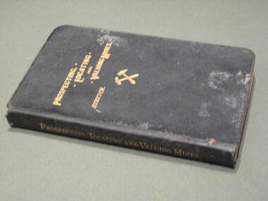 Federation University Historical Collection
Book, Prospecting, Locating and Valuing Mines, 1902
This book was most probably used at the Ballarat School of Mines.Black covered book with gold title. 381 pages. The book was 'a popular treatise for the use of prospectors, investors and Mining Men generally; with an account of the Principal Minerals and Country rocks; Ore Deposits; Locations and Patents; the early Development of Mines; Earthy Mineral Products; Coal; Gold gravels and gravel Mining; Measurement of Water; and Artesian Wells'.mining, ballarat school of mines, water, geology -
 Federation University Historical Collection
Book, Mining Engineers Handbook Volume 1 & 2, 1941
The book was used by Charles Bacon who studied at the University of Nevada in the late 1930s/early 1940s. Bacon worked at Bunker Hill Mines and Kellogg Idaho, before arriving in Australian in 1951. He worked for CN Myers, a company involved with paper converting. CN Myers was a family business (on Charles Bacon's maternal line). Robert Peele was Professor Emeritus of mining Engineering at the School of Mines, Columbia University.Maroon hardcovered books. .1) Volume 1 - Chapters include Mineralogy, Geology and Mineral Deposits, Earth Excavation, Explosives, Rock Excavation, Tunneling, Shaft Sinking in Rock, Shaft sinking in Unstable and Waterbearing Ground, Boring, Underground Transport, Mine Ventilation. .2) Volume 2 - Chapers include Compressed Air Practice, Electric Power for mine Service, Surveying,Underground Surveying, Mine Geologic Maps and models, Cost of mining, Mining Laws, Ore sampling, Assaying, Aerial Tramways and Cableways, Gold Amalgamation and Cyanidation, etc.Inside front cover "Charles Bacon"charles bacon, mining engineering, mining, engineering, university of nevada, mackay school of mines, explosives, timbering -
Federation University Historical Collection
Book, Australasian Institute of Mining Engineers, Transactions of the Australasian Institute of Mining Engineers, Volume X, 1905
Fabric covered hardcovered book of 367 pages. Includes a number of pullout plans. Contents * Mount Lyell Mining Field Tasmania by Professor J.W. Gregory * Concentration of solver-led ores (with 6 plates) by V.F. Stanley Low * Phosphate Deposites of Ocean and Pleasnt Islands (with 15 plates) by F. Danvers Power * Coal and Coal Mining in New SoPleassant Isuth Wales by Thomas Parton * Method of TImbering at the Mount Rex Tin Mne, Ben Lomand, Tasmania by Mark Ireland * Peck's Centrifugal Elevator by W. Peck * A Portable Assay Furnace by J.J. Gillio * NOtes on Sampling by A.C. Thomas * The Career of the Gold Dredge i n New South Wales by David K. Blair * The Transmission of Power by COmpressed Air in Mines by R.W. Chapman * The Misplacement of Mning Shafts and Adits in Victoria (with 7 figures) * The Indicators of the Daylesford Gold Mines, Victoria * Mining Accounts by R.N. Kirknon-fictionausimm, a.s. kenyon, frank a. moss, mount lyell, j.w. gregory, coal, gold dredge, transmission of power, mining shaft audits, daylesford gold mines, spitzkastens, ocean island banaba, pleasant island nauru, pinnacles on flat reef pleasant island, ocean island, blow hole howe bay, rock phosphate, thomas parton, mark ireland, mount rex tin mine, ngapara dredge, w. peck, w.h. vale, daylesford, jim crow diggings, glenmona gmc, f. danvers power, leigh g. hancock, workers' industrial union of australia (barrier district) -
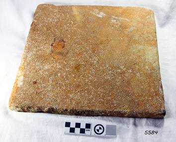 Flagstaff Hill Maritime Museum and Village
Marble Tile, circa 1878
The artefact is a white marble tile raised from the wreck of the LOCH ARD (1878). The cargo manifest of the sunken vessel has the entry “Marble £400”. This is placed directly following the entry “Glass (604 cases)”. This conjunction suggests the marble tile was originally part of a consignment intended for use in a ‘high end’ residential or public building project in the gold and wool rich Colony of Victoria. Traditionally, white or cream marble was imported into Britain from the Mediterranean region of Europe, where beds of sedimentary limestone (calcium and magnesium carbonate) had been buried over a long geological period of time. Deep in the earth’s crust, it had been subjected to immense pressures and high temperatures, sufficient to completely re-crystallise the original deposits. Marble beds began as layers of sediment at the bottom of ancient tropical seas, forming from the skeletal remains of calcareous fossils, shell, and coral fragments. The metamorphic process of prolonged compression and heating recrystallised this skeletal material, destroying all signs of the original sedimentary fabric. The resulting ‘true’ marbles of, for example, White Carrara (Tuscany, Italy), Verdi (green) Antico (Thessaly, Greece), and Rouge (red) Languadoc (Carcassone, France), were highly prized in classical decoration (sculpture and friezes) and architecture (temples and arches). Marble was found in nineteenth century Australia, but in small, uneconomic deposits, not suitable for commercial quarrying. The comparative expense of imported marble restricted its use in colonial buildings to carved fireplaces and mantel pieces, or outdoor ornaments such as fountains, statuary and grave stones. If Carrara marble floor tiles were used, they were used sparingly, as an arresting feature in entrance halls for instance. However, most prominent private and public construction used timber flooring, waxed or ‘japanned’, with carpet runners and rugs (for example the Austin’s Barwon Park Mansion, 1871), or laid tessellated and ceramic tiles of baked clay infused with colour (for example the Chirnside’s Werribee Park Mansion, 1878). HISTORY OF THE LOCH ARD The LOCH ARD belonged to the famous Loch Line which sailed many ships from England to Australia. Built in Glasgow by Barclay, Curdle and Co. in 1873, the LOCH ARD was a three-masted square rigged iron sailing ship. The ship measured 262ft 7" (79.87m) in length, 38ft (11.58m) in width, 23ft (7m) in depth and had a gross tonnage of 1693 tons. The LOCH ARD's main mast measured a massive 150ft (45.7m) in height. LOCH ARD made three trips to Australia and one trip to Calcutta before its final voyage. LOCH ARD left England on March 2, 1878, under the command of Captain Gibbs, a newly married, 29 year old. She was bound for Melbourne with a crew of 37, plus 17 passengers and a load of cargo. The general cargo reflected the affluence of Melbourne at the time. On board were straw hats, umbrella, perfumes, clay pipes, pianos, clocks, confectionary, linen and candles, as well as a heavier load of railway irons, cement, lead and copper. There were items included that intended for display in the Melbourne International Exhibition in 1880. The voyage to Port Phillip was long but uneventful. At 3am on June 1, 1878, Captain Gibbs was expecting to see land and the passengers were becoming excited as they prepared to view their new homeland in the early morning. But LOCH ARD was running into a fog which greatly reduced visibility. Captain Gibbs was becoming anxious as there was no sign of land or the Cape Otway lighthouse. At 4am the fog lifted. A man aloft announced that he could see breakers. The sheer cliffs of Victoria's west coast came into view, and Captain Gibbs realised that the ship was much closer to them than expected. He ordered as much sail to be set as time would permit and then attempted to steer the vessel out to sea. On coming head on into the wind, the ship lost momentum, the sails fell limp and LOCH ARD's bow swung back. Gibbs then ordered the anchors to be released in an attempt to hold its position. The anchors sank some 50 fathoms - but did not hold. By this time LOCH ARD was among the breakers and the tall cliffs of Mutton Bird Island rose behind the ship. Just half a mile from the coast, the ship's bow was suddenly pulled around by the anchor. The captain tried to tack out to sea, but the ship struck a reef at the base of Mutton Bird Island, near Port Campbell. Waves broke over the ship and the top deck was loosened from the hull. The masts and rigging came crashing down knocking passengers and crew overboard. When a lifeboat was finally launched, it crashed into the side of LOCH ARD and capsized. Tom Pearce, who had launched the boat, managed to cling to its overturned hull and shelter beneath it. He drifted out to sea and then on the flood tide came into what is now known as LOCH ARD Gorge. He swam to shore, bruised and dazed, and found a cave in which to shelter. Some of the crew stayed below deck to shelter from the falling rigging but drowned when the ship slipped off the reef into deeper water. Eva Carmichael had raced onto deck to find out what was happening only to be confronted by towering cliffs looming above the stricken ship. In all the chaos, Captain Gibbs grabbed Eva and said, "If you are saved Eva, let my dear wife know that I died like a sailor". That was the last Eva Carmichael saw of the captain. She was swept off the ship by a huge wave. Eva saw Tom Pearce on a small rocky beach and yelled to attract his attention. He dived in and swam to the exhausted woman and dragged her to shore. He took her to the cave and broke open case of brandy which had washed up on the beach. He opened a bottle to revive the unconscious woman. A few hours later Tom scaled a cliff in search of help. He followed hoof prints and came by chance upon two men from nearby Glenample Station three and a half miles away. In a state of exhaustion, he told the men of the tragedy. Tom returned to the gorge while the two men rode back to the station to get help. By the time they reached LOCH ARD Gorge, it was cold and dark. The two shipwreck survivors were taken to Glenample Station to recover. Eva stayed at the station for six weeks before returning to Ireland, this time by steamship. In Melbourne, Tom Pearce received a hero's welcome. He was presented with the first gold medal of the Royal Humane Society of Victoria and a £1000 cheque from the Victorian Government. Concerts were performed to honour the young man's bravery and to raise money for those who lost family in the LOCH ARD disaster. Of the 54 crew members and passengers on board, only two survived: the apprentice, Tom Pearce and the young woman passenger, Eva Carmichael, who lost all of her family in the tragedy. Ten days after the LOCH ARD tragedy, salvage rights to the wreck were sold at auction for £2,120. Cargo valued at £3,000 was salvaged and placed on the beach, but most washed back into the sea when another storm developed. The wreck of LOCH ARD still lies at the base of Mutton Bird Island. Much of the cargo has now been salvaged and some was washed up into what is now known as LOCH ARD Gorge. Cargo and artefacts have also been illegally salvaged over many years before protective legislation was introduced. One of the most unlikely pieces of cargo to have survived the shipwreck was a Minton porcelain peacock - one of only nine in the world. The peacock was destined for the Melbourne International Exhibition in 1880. It had been well packed, which gave it adequate protection during the violent storm. Today, the Minton peacock can be seen at the Flagstaff Hill Maritime Museum in Warrnambool. From Australia's most dramatic shipwreck it has now become Australia's most valuable shipwreck artefact and is one of very few 'objects' on the Victorian State Heritage Register. The wreck of the LOCH ARD is of State significance — Victorian Heritage Register S417 Flagstaff Hill’s collection of artefacts from LOCH ARD is significant for being one of the largest collections of artefacts from this shipwreck in Victoria. It is significant for its association with the shipwreck, which is on the Victorian Heritage Register (VHR S417). The collection is significant because of the relationship between the objects, as together they have a high potential to interpret the story of the LOCH ARD. The LOCH ARD collection is archaeologically significant as the remains of a large international passenger and cargo ship. The LOCH ARD collection is historically significant for representing aspects of Victoria’s shipping history and its potential to interpret sub-theme 1.5 of Victoria’s Framework of Historical Themes (living with natural processes). The collection is also historically significant for its association with the LOCH ARD, which was one of the worst and best known shipwrecks in Victoria’s history. A square marble tile retrieved from the wreck of the LOCH ARD. Most of its surface is covered by a thin layer of limestone and marine growth encrustation that is stained rust-red. The tile is ‘rough-worked’, cut to shape and size, but not smoothed or polished. There is a companion tile in similar condition in the Flagstaff Hill collection. From visual observation of the original surface (at low magnification) the tile appears to be of white Carrara-type marble.flagstaff hill, warrnambool, shipwrecked coast, flagstaff hill maritime museum, maritime museum, shipwreck coast, flagstaff hill maritime village, great ocean road, loch line, loch ard, captain gibbs, eva carmichael, tom pearce, glenample station, mutton bird island, loch ard gorge, white marble, marble tile, carrara marble, imported marble, colonial architecture, victorian building materials -
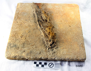 Flagstaff Hill Maritime Museum and Village
Marble Tile, circa 1878
The artefact is a white marble tile raised from the wreck of the LOCH ARD (1878). The cargo manifest of the sunken vessel has the entry “Marble £400”. This is placed directly following the entry “Glass (604 cases)”. This conjunction suggests the marble tile was originally part of a consignment intended for use in a ‘high end’ residential or public building project in the gold and wool rich Colony of Victoria. Traditionally, white or cream marble was imported into Britain from the Mediterranean region of Europe, where beds of sedimentary limestone (calcium and magnesium carbonate) had been buried over a long geological period of time. Deep in the earth’s crust, it had been subjected to immense pressures and high temperatures, sufficient to completely re-crystallise the original deposits. Marble beds began as layers of sediment at the bottom of ancient tropical seas, forming from the skeletal remains of calcareous fossils, shell, and coral fragments. The metamorphic process of prolonged compression and heating recrystallised this skeletal material, destroying all signs of the original sedimentary fabric. The resulting ‘true’ marbles of, for example, White Carrara (Tuscany, Italy), Verdi (green) Antico (Thessaly, Greece), and Rouge (red) Languadoc (Carcassone, France), were highly prized in classical decoration (sculpture and friezes) and architecture (temples and arches). Marble was found in nineteenth century Australia, but in small, uneconomic deposits, not suitable for commercial quarrying. The comparative expense of imported marble restricted its use in colonial buildings to carved fireplaces and mantel pieces, or outdoor ornaments such as fountains, statuary and grave stones. If Carrara marble floor tiles were used, they were used sparingly, as an arresting feature in entrance halls for instance. However, most prominent private and public construction used timber flooring, waxed or ‘jappaned’, with carpet runners and rugs (for example the Austin’s Barwon Park Mansion, 1871), or laid tessellated and ceramic tiles of baked clay infused with colour (for example the Chirnside’s Werribee Park Mansion, 1878). HISTORY OF THE LOCH ARD The LOCH ARD belonged to the famous Loch Line which sailed many ships from England to Australia. Built in Glasgow by Barclay, Curdle and Co. in 1873, the LOCH ARD was a three-masted square rigged iron sailing ship. The ship measured 262ft 7" (79.87m) in length, 38ft (11.58m) in width, 23ft (7m) in depth and had a gross tonnage of 1693 tons. The LOCH ARD's main mast measured a massive 150ft (45.7m) in height. LOCH ARD made three trips to Australia and one trip to Calcutta before its final voyage. LOCH ARD left England on March 2, 1878, under the command of Captain Gibbs, a newly married, 29 year old. She was bound for Melbourne with a crew of 37, plus 17 passengers and a load of cargo. The general cargo reflected the affluence of Melbourne at the time. On board were straw hats, umbrella, perfumes, clay pipes, pianos, clocks, confectionary, linen and candles, as well as a heavier load of railway irons, cement, lead and copper. There were items included that intended for display in the Melbourne International Exhibition in 1880. The voyage to Port Phillip was long but uneventful. At 3am on June 1, 1878, Captain Gibbs was expecting to see land and the passengers were becoming excited as they prepared to view their new homeland in the early morning. But LOCH ARD was running into a fog which greatly reduced visibility. Captain Gibbs was becoming anxious as there was no sign of land or the Cape Otway lighthouse. At 4am the fog lifted. A man aloft announced that he could see breakers. The sheer cliffs of Victoria's west coast came into view, and Captain Gibbs realised that the ship was much closer to them than expected. He ordered as much sail to be set as time would permit and then attempted to steer the vessel out to sea. On coming head on into the wind, the ship lost momentum, the sails fell limp and LOCH ARD's bow swung back. Gibbs then ordered the anchors to be released in an attempt to hold its position. The anchors sank some 50 fathoms - but did not hold. By this time LOCH ARD was among the breakers and the tall cliffs of Mutton Bird Island rose behind the ship. Just half a mile from the coast, the ship's bow was suddenly pulled around by the anchor. The captain tried to tack out to sea, but the ship struck a reef at the base of Mutton Bird Island, near Port Campbell. Waves broke over the ship and the top deck was loosened from the hull. The masts and rigging came crashing down knocking passengers and crew overboard. When a lifeboat was finally launched, it crashed into the side of LOCH ARD and capsized. Tom Pearce, who had launched the boat, managed to cling to its overturned hull and shelter beneath it. He drifted out to sea and then on the flood tide came into what is now known as LOCH ARD Gorge. He swam to shore, bruised and dazed, and found a cave in which to shelter. Some of the crew stayed below deck to shelter from the falling rigging but drowned when the ship slipped off the reef into deeper water. Eva Carmichael had raced onto deck to find out what was happening only to be confronted by towering cliffs looming above the stricken ship. In all the chaos, Captain Gibbs grabbed Eva and said, "If you are saved Eva, let my dear wife know that I died like a sailor". That was the last Eva Carmichael saw of the captain. She was swept off the ship by a huge wave. Eva saw Tom Pearce on a small rocky beach and yelled to attract his attention. He dived in and swam to the exhausted woman and dragged her to shore. He took her to the cave and broke open case of brandy which had washed up on the beach. He opened a bottle to revive the unconscious woman. A few hours later Tom scaled a cliff in search of help. He followed hoof prints and came by chance upon two men from nearby Glenample Station three and a half miles away. In a state of exhaustion, he told the men of the tragedy. Tom returned to the gorge while the two men rode back to the station to get help. By the time they reached LOCH ARD Gorge, it was cold and dark. The two shipwreck survivors were taken to Glenample Station to recover. Eva stayed at the station for six weeks before returning to Ireland, this time by steamship. In Melbourne, Tom Pearce received a hero's welcome. He was presented with the first gold medal of the Royal Humane Society of Victoria and a £1000 cheque from the Victorian Government. Concerts were performed to honour the young man's bravery and to raise money for those who lost family in the LOCH ARD disaster. Of the 54 crew members and passengers on board, only two survived: the apprentice, Tom Pearce and the young woman passenger, Eva Carmichael, who lost all of her family in the tragedy. Ten days after the LOCH ARD tragedy, salvage rights to the wreck were sold at auction for £2,120. Cargo valued at £3,000 was salvaged and placed on the beach, but most washed back into the sea when another storm developed. The wreck of LOCH ARD still lies at the base of Mutton Bird Island. Much of the cargo has now been salvaged and some was washed up into what is now known as LOCH ARD Gorge. Cargo and artefacts have also been illegally salvaged over many years before protective legislation was introduced. One of the most unlikely pieces of cargo to have survived the shipwreck was a Minton porcelain peacock - one of only nine in the world. The peacock was destined for the Melbourne International Exhibition in 1880. It had been well packed, which gave it adequate protection during the violent storm. Today, the Minton peacock can be seen at the Flagstaff Hill Maritime Museum in Warrnambool. From Australia's most dramatic shipwreck it has now become Australia's most valuable shipwreck artefact and is one of very few 'objects' on the Victorian State Heritage Register. HISTORY OF THE LOCH ARD The LOCH ARD belonged to the famous Loch Line which sailed many ships from England to Australia. Built in Glasgow by Barclay, Curdle and Co. in 1873, the LOCH ARD was a three-masted square rigged iron sailing ship. The ship measured 262ft 7" (79.87m) in length, 38ft (11.58m) in width, 23ft (7m) in depth and had a gross tonnage of 1693 tons. The LOCH ARD's main mast measured a massive 150ft (45.7m) in height. LOCH ARD made three trips to Australia and one trip to Calcutta before its final voyage. LOCH ARD left England on March 2, 1878, under the command of Captain Gibbs, a newly married, 29 year old. She was bound for Melbourne with a crew of 37, plus 17 passengers and a load of cargo. The general cargo reflected the affluence of Melbourne at the time. On board were straw hats, umbrella, perfumes, clay pipes, pianos, clocks, confectionary, linen and candles, as well as a heavier load of railway irons, cement, lead and copper. There were items included that intended for display in the Melbourne International Exhibition in 1880. The voyage to Port Phillip was long but uneventful. At 3am on June 1, 1878, Captain Gibbs was expecting to see land and the passengers were becoming excited as they prepared to view their new homeland in the early morning. But LOCH ARD was running into a fog which greatly reduced visibility. Captain Gibbs was becoming anxious as there was no sign of land or the Cape Otway lighthouse. At 4am the fog lifted. A man aloft announced that he could see breakers. The sheer cliffs of Victoria's west coast came into view, and Captain Gibbs realised that the ship was much closer to them than expected. He ordered as much sail to be set as time would permit and then attempted to steer the vessel out to sea. On coming head on into the wind, the ship lost momentum, the sails fell limp and LOCH ARD's bow swung back. Gibbs then ordered the anchors to be released in an attempt to hold its position. The anchors sank some 50 fathoms - but did not hold. By this time LOCH ARD was among the breakers and the tall cliffs of Mutton Bird Island rose behind the ship. Just half a mile from the coast, the ship's bow was suddenly pulled around by the anchor. The captain tried to tack out to sea, but the ship struck a reef at the base of Mutton Bird Island, near Port Campbell. Waves broke over the ship and the top deck was loosened from the hull. The masts and rigging came crashing down knocking passengers and crew overboard. When a lifeboat was finally launched, it crashed into the side of LOCH ARD and capsized. Tom Pearce, who had launched the boat, managed to cling to its overturned hull and shelter beneath it. He drifted out to sea and then on the flood tide came into what is now known as LOCH ARD Gorge. He swam to shore, bruised and dazed, and found a cave in which to shelter. Some of the crew stayed below deck to shelter from the falling rigging but drowned when the ship slipped off the reef into deeper water. Eva Carmichael had raced onto deck to find out what was happening only to be confronted by towering cliffs looming above the stricken ship. In all the chaos, Captain Gibbs grabbed Eva and said, "If you are saved Eva, let my dear wife know that I died like a sailor". That was the last Eva Carmichael saw of the captain. She was swept off the ship by a huge wave. Eva saw Tom Pearce on a small rocky beach and yelled to attract his attention. He dived in and swam to the exhausted woman and dragged her to shore. He took her to the cave and broke open case of brandy which had washed up on the beach. He opened a bottle to revive the unconscious woman. A few hours later Tom scaled a cliff in search of help. He followed hoof prints and came by chance upon two men from nearby Glenample Station three and a half miles away. In a state of exhaustion, he told the men of the tragedy. Tom returned to the gorge while the two men rode back to the station to get help. By the time they reached LOCH ARD Gorge, it was cold and dark. The two shipwreck survivors were taken to Glenample Station to recover. Eva stayed at the station for six weeks before returning to Ireland, this time by steamship. In Melbourne, Tom Pearce received a hero's welcome. He was presented with the first gold medal of the Royal Humane Society of Victoria and a £1000 cheque from the Victorian Government. Concerts were performed to honour the young man's bravery and to raise money for those who lost family in the LOCH ARD disaster. Of the 54 crew members and passengers on board, only two survived: the apprentice, Tom Pearce and the young woman passenger, Eva Carmichael, who lost all of her family in the tragedy. Ten days after the LOCH ARD tragedy, salvage rights to the wreck were sold at auction for £2,120. Cargo valued at £3,000 was salvaged and placed on the beach, but most washed back into the sea when another storm developed. The wreck of LOCH ARD still lies at the base of Mutton Bird Island. Much of the cargo has now been salvaged and some was washed up into what is now known as LOCH ARD Gorge. Cargo and artefacts have also been illegally salvaged over many years before protective legislation was introduced. One of the most unlikely pieces of cargo to have survived the shipwreck was a Minton porcelain peacock - one of only nine in the world. The peacock was destined for the Melbourne International Exhibition in 1880. It had been well packed, which gave it adequate protection during the violent storm. Today, the Minton peacock can be seen at the Flagstaff Hill Maritime Museum in Warrnambool. From Australia's most dramatic shipwreck it has now become Australia's most valuable shipwreck artefact and is one of very few 'objects' on the Victorian State Heritage Register. The wreck of the LOCH ARD is of State significance — Victorian Heritage Register S417 Flagstaff Hill’s collection of artefacts from LOCH ARD is significant for being one of the largest collections of artefacts from this shipwreck in Victoria. It is significant for its association with the shipwreck, which is on the Victorian Heritage Register (VHR S417). The collection is significant because of the relationship between the objects, as together they have a high potential to interpret the story of the LOCH ARD. The LOCH ARD collection is archaeologically significant as the remains of a large international passenger and cargo ship. The LOCH ARD collection is historically significant for representing aspects of Victoria’s shipping history and its potential to interpret sub-theme 1.5 of Victoria’s Framework of Historical Themes (living with natural processes). The collection is also historically significant for its association with the LOCH ARD, which was one of the worst and best known shipwrecks in Victoria’s history. A square marble tile retrieved from the wreck of the LOCH ARD. Most of its surface is covered by a thin layer of limestone and marine growth encrustation that is stained rust-red. There is a piece of corroded iron encrusted at an oblique angle on the tile’s rear face. The tile is ‘rough-worked’, cut to shape and size, but not smoothed or polished. There is a companion tile in similar condition in the Flagstaff Hill collection. From visual observation of the original surface (at low magnification) the tile appears to be of white Carrara-type marble.flagstaff hill, warrnambool, shipwrecked coast, flagstaff hill maritime museum, maritime museum, shipwreck coast, flagstaff hill maritime village, great ocean road, loch line, loch ard, captain gibbs, eva carmichael, tom pearce, glenample station, mutton bird island, loch ard gorge, white marble, marble tile, carrara marble, colonial architecture, victorian building materials -
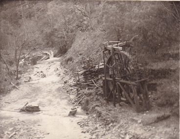 The Beechworth Burke Museum
Postcard, 1920
This postcard depicts the set-up of an abandoned gold mine. This includes a water wheel and other mining implements next to a creek. The postcard inscription indicates that this image is of the remains of the Wallaby Reef battery and water wheel. Wallaby Reef was discovered in 1864, and a prospecting claim established a four head battery and water wheel. Quartz was mined there, with gold also discovered at this location at a later date. By 1878 the mine was no longer resulting in rich deposits, this resulted in the miners moving their search for gold closer to the river where they were able to access more gold. This was in approximately 1879. In 1882 a rich deposit was found. In 1908 the battery was closed, and the mine finished. This photo was taken in 1920 and shows the deterioration of the site since its closure. Gold mining was crucial to the development of the Beechworth area. It has strong research and historical value because the clarity of the photo shows all the minute details of the mining equipment. The text on the back also indicates the mine is the Wallaby Mine, which was used for 45 years to find gold and quartz. Therefore, due to the location being quickly abandoned, this site is a rich location for historical study on gold mining during the 1900s. It can provide important information on the types of tools utilised and the impact of the mining on the environment.Black and white postcard photograph on card.8169 Be / Also near Wallaby Reef Workings / Relics of Rechabite Reef (locality) workings. / Shaft in bed of creek. Wheel used to drive sheadd (?) / stamp battery too I believe near B'worth 1920?beechworth, mining, gold mining, quartz mining, wallaby reef mine, mine battery head